Predictive Climate Intelligence

Prevent Heat Risk Before It Happens

AI-powered hyperlocal heat intelligence predicting street-level risk at 100m resolution. Empowering cities to save lives and protect infrastructure.

Core Goals

We bridge the gap between traditional 1km–25km weather forecasts and street-level reality, delivering actionable intelligence where it matters most.

100m Resolution

Predict hyperlocal heat conditions at an unprecedented 100m spatial resolution to identify exact risk zones.

7-Day Horizon

Generate precise hourly forecasts for up to 7 days, allowing proactive rather than reactive responses.

UHI Detection

Detect Urban Heat Island intensity, identifying heat accumulation zones and heat-retaining infrastructure.

Health Risk Indicators

Produce complex heat-health risk indicators including WBGT, Feels-Like temperature, and mortality risk scores.

Platform Features

A comprehensive suite of predictive tools powered by hybrid physics and AI architectures.
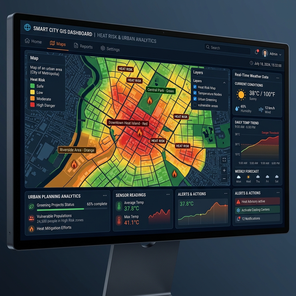
Spatial Analytics

Hyperlocal Temperature Prediction

Transform coarse 1–5km forecasts into street-level intelligence. By combining base weather data with GIS modeling and satellite intelligence, our AI Downscaling Engine creates precise 100m predictive grids.

  • Hourly basis forecasting
  • Interactive heat maps
  • Spatial analytics and reporting
AI Downscaling Neural Network
Risk Assessment

Advanced Heat Risk Scoring

We go beyond simple air temperature. Our AI-generated heat-risk severity scoring calculates thermal stress levels by fusing multiple environmental factors.

  • WBGT (Wet Bulb Globe Temperature)
  • Feels-Like Temperature integration
  • Population vulnerability cross-referencing
  • Heat Mortality Risk estimation
Interactive GIS Dashboard

Who It's For

Actionable intelligence tailored to those responsible for climate resilience.

Municipal Corporations

Heatwave preparedness, urban cooling planning, and targeted public advisories.

Disaster Management

High-risk zone monitoring, resource deployment, and automated emergency alerting.

Public Health

Heat mortality risk monitoring, vulnerable population analysis, and health interventions.

Urban Planners

Urban heat island analysis, real estate site heat analysis, and climate adaptation.

System Architecture

A hybrid architecture combining physics-based weather data with AI downscaling.

1. Base Weather Forecast Ingestion

1km–25km resolution baseline

ERA5 NOAA GFS ECMWF IMD

2. Geospatial & Satellite Intelligence

Capturing urban microclimate behavior

DEM / Land-use Landsat / Sentinel NDVI

3. AI-Based Downscaling Engine

100m Hyperlocal Prediction

CNN Spatial Super Resolution ConvLSTM Spatiotemporal UNet Feature Fusion

4. Heat-Health Analytics & Outputs

Actionable Intelligence

WBGT & Feels-Like Mortality Risk Score GIS Dashboard